Posbankroute - optimized v2
The original Rhedense 'Posbankroute' (52km), crossing the highest hills of the Veluwezoom and Loenermark, is one of the most beautiful mountainbike tracks that we have.
By eliminating almost every single meter of asfalt, and adding some great paths and single tracks instead,
I have created the most fantastic GPS mountainbike route of Holland!!
Posbankroute, Lu's optimized version (57km):
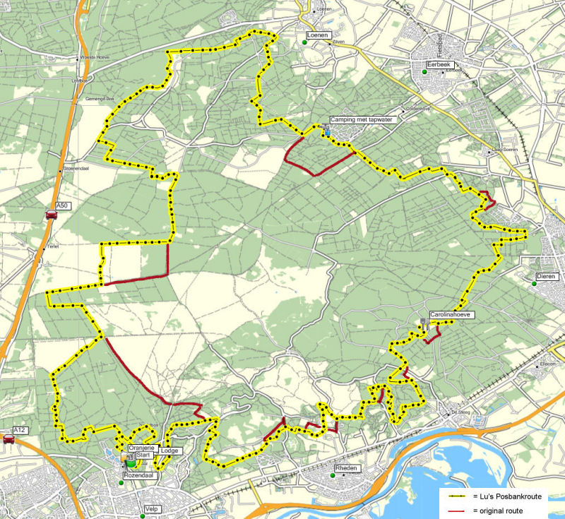
Click here to view map in high detail.
In EveryTrail view with alti profile:
Check this route and others at EveryTrail Travel Guides
Download the route with optimum accuracy and max 500 trackpoints (required for Garmin) from here:
Lu's Posbankroute.gdb
Lu's Posbankroute.dxf
Lu's Posbankroute.mps
Start and Finish are at a large parking area near the castle in Rozendaal, this version is optimized for clockwise riding.
At 50% of the route you will cross camping Coldenhove where you can get yourself a water refill. At 70% of the route you will pass by the old
farmhouse Carolinahoeve which is a nice pancake restaurant. With a big terras in the middle of the
Veluwezoom this is a great place for a break. Get yourself a drink with a piece of apple cake, or even a
pancake for the big hungry if you like.
Tip: After the ride have a drink at the terras of the Oranjerie with a fabulous view at the castle and its garden, or even better for the view and great lounging, the Hunting Lodge
which is just as close.
It's very easy to reach the start in Rozendaal, showing below when coming from either the A12 (Utrecht) or the A50 (Apeldoorn).
From both freeways take the exit "Arnhem Centrum" and "Burgers Zoo" and follow the signs towards "Velp". Then at the roundabout take the 3rd exit which leads towards
the caste, and the Hunting Lodge. After about 400m, where the road goes up-hill again, you'll find the parking area on your right hand side.
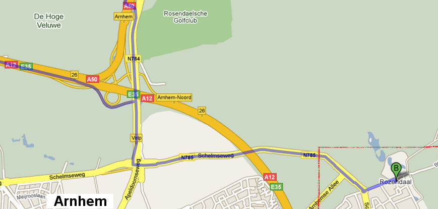
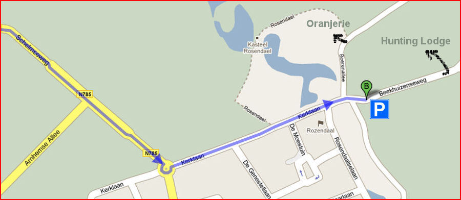
Or simply navigate to Beekhuizenseweg 4 in Rozendaal, the parking area is behind it at coordinate N 52 0.492, E 5 58.000
Disclaimer:
You will be riding through areas where officially crossing by bike is prohibited. I will not be responsible for any consequenses.
Advise:
The paths are shared with others such as hikers. Treat them with respect, slow down while passing by and warn them in advance when you're coming from
behind by using a simple bell, not yelling.
Trip on 23-5-2010 together with buddy Marten, starting from the lowest point at Siedlinghausen instead of Willingen:
Bike-Arena Sauerland 'Hochplateau Tour'
Total distance: 60km Map your trip with EveryTrail